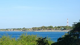
Santa
Appearance
Page Module:Infobox/styles.css has no content.
| Santa | |
|---|---|
| Baley na Filipinas | |
 | |
 Lokasyon na Santa | |
 | |
| 17°29′10″N 120°26′4″E | |
| Dalin | Filipinas |
| Barangay | 26 |
| Kaawang | |
| • Katiponan | 109.10 km2 (42.12 sq mi) |
| Elebasyon | 72 m (236 ft) |
| Bilang na too (Mayo 1, 2020)[1] | |
| • Katiponan | 14,992 |
| • Densidad | 140/km2 (360/sq mi) |
| Economia | |
| • Clase | kumapat ya klase ya baley |
| • Ingresos | ₱145,929,054.3770,755,068.9169,022,794.5749,759,886.0357,428,398.5698,459,003.4469,466,199.3981,883,146.29214,180,635.99225,575,833.29 (2020) |
| • Activos | ₱437,259,777.2490,681,198.93102,440,111.1395,291,202.60105,970,970.46148,331,931.91255,870,931.65377,544,733.71378,867,830.51564,574,109.10687,501,278.43 (2020) |
| • Pasivos | ₱26,037,569.4618,934,526.168,397,811.2715,490,335.2926,372,900.4631,087,635.8135,002,454.5544,620,334.8529,274,441.5130,368,621.1513,276,564.44 (2020) |
| • Gastos | ₱101,930,046.7044,087,944.0046,608,696.1147,168,176.3958,322,187.1266,607,525.0470,418,047.5170,314,911.1175,565,783.2699,393,916.92112,268,783.54 (2020) |
| Kodigo na postal | 2703 |
| Kodigo na lugar | 77 |
| Website | www |
Say Santa et kumapat ya klase ya baley ed luyag na Ilocos ed Abalaten, Filipinas. Unong ed 1 Mayo 2020 census, say populasyon to et 14,992 totoo tan 3,661 abong. Walay kabaleg tan sukat to ya 109.10 sq. km. Say zip code to et 2703.
Saray barangay
[dumaen | dumaen so pinanlapuan]- Ampandula
- Banaoang
- Basug
- Bucalag
- Cabangaran
- Calungboyan
- Casiber
- Dammay
- Labut Norte
- Labut Sur
- Mabilbila Sur
- Mabilbila Norte
- Magsaysay District (Pob.)
- Manueva
- Marcos (Pob.)
- Nagpanaoan
- Namalangan
- Oribi
- Pasungol
- Quezon (Pob.)
- Quirino (Pob.)
- Rancho
- Rizal
- Sacuyya Norte
- Sacuyya Sur
- Tabucolan
Demograpiko
[dumaen | dumaen so pinanlapuan]| Taon | Pop. | ±% p.a. |
|---|---|---|
| 1903 | 8,063 | — |
| 1918 | 9,748 | +1.27% |
| 1939 | 10,174 | +0.20% |
| 1948 | 8,917 | −1.45% |
| 1960 | 10,214 | +1.14% |
| 1970 | 10,859 | +0.61% |
| 1975 | 11,799 | +1.68% |
| 1980 | 11,359 | −0.76% |
| 1990 | 12,570 | +1.02% |
| 1995 | 12,801 | +0.34% |
| 2000 | 13,918 | +1.81% |
| 2007 | 14,059 | +0.14% |
| 2010 | 15,106 | +2.65% |
| 2015 | 15,340 | +0.29% |
| 2020 | 14,992 | −0.45% |
| Reperensiya: Philippine Statistics Authority[2][3][4] | ||
Saray reperensiya
[dumaen | dumaen so pinanlapuan]- ↑ "2020 Census of Population and Housing (2020 CPH) Population Counts Declared Official by the President". Hulyo 7, 2021. https://psa.gov.ph/content/2020-census-population-and-housing-2020-cph-population-counts-declared-official-president.
- ↑ Census of Population (2015). "Region I (Ilocos Region)". Total Population by Province, City, Municipality and Barangay. PSA. Retrieved 29 June 2016.
- ↑ Census of Population and Housing (2010). "Region I (Ilocos Region)". Total Population by Province, City, Municipality and Barangay. NSO. Retrieved 29 June 2016.
- ↑ Censuses of Population (1903–2007). "Region I (Ilocos Region)". Table 1. Population Enumerated in Various Censuses by Province/Highly Urbanized City: 1903 to 2007. NSO.
