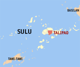
Talipao
Appearance
Page Module:Infobox/styles.css has no content.
| Talipao | |
|---|---|
| Baley na Filipinas | |
 Lokasyon na Talipao | |
 | |
| 5°58′34″N 121°6′31″E | |
| Dalin | Filipinas |
| Barangay | 52 |
| Kaawang | |
| • Katiponan | 380.57 km2 (146.94 sq mi) |
| Elebasyon | 157 m (515 ft) |
| Bilang na too (Mayo 1, 2020)[1] | |
| • Katiponan | 100,088 |
| • Densidad | 260/km2 (680/sq mi) |
| Economia | |
| • Clase | unaan ya klase ya baley |
| • Ingresos | ₱259,295,883.18 (2020) |
| • Activos | ₱300,557,664.25 (2020) |
| • Pasivos | ₱32,740,511.51 (2020) |
| • Gastos | ₱213,005,274.87 (2020) |
| Kodigo na postal | 7403 |
| Kodigo na lugar | 68 |
| Website | www |
Say Talipao et unaan ya klase ya baley ed luyag na Sulu, Filipinas. Unong ed 1 Mayo 2020 census, say populasyon to et 100,088 totoo tan 15,853 abong. Walay kabaleg tan sukat to ya 380.57 sq. km. Say zip code to et 7403.
Saray barangay
[dumaen | dumaen so pinanlapuan]- Andalan
- Bagsak
- Bandang
- Bilaan (Pob.)
- Bud Bunga
- Buntod
- Buroh
- Dalih
- Gata
- Kabatuhan Bilaan
- Kabatuhan Tiis
- Kabungkol
- Kagay
- Kahawa
- Kandaga
- Kanlibot
- Kiutaan
- Kuhaw
- Kulamboh
- Kuttong
- Lagtoh
- Lambanah
- Liban
- Liu-Bud Pantao
- Lower Binuang
- Lower Kamuntayan
- Lower Laus
- Lower Sinumaan
- Lower Talipao
- Lumbayao
- Lumping Pigih Daho
- Lungkiaban
- Mabahay
- Mahala
- Mampallam
- Marsada
- Mauboh
- Mungit-mungit
- Niog-Sangahan
- Pantao
- Samak
- Talipao Proper
- Tampakan
- Tiis
- Tinggah
- Tubod
- Tuyang
- Upper Binuang
- Upper Kamuntayan
- Upper Laus
- Upper Sinumaan
- Upper Talipao
Demograpiko
[dumaen | dumaen so pinanlapuan]| Taon | Pop. | ±% p.a. |
|---|---|---|
| 1918 | 5,871 | — |
| 1939 | 11,064 | +3.06% |
| 1948 | 8,650 | −2.70% |
| 1960 | 18,553 | +6.56% |
| 1970 | 32,111 | +5.63% |
| 1975 | 15,612 | −13.47% |
| 1980 | 25,853 | +10.61% |
| 1990 | 66,261 | +9.87% |
| 1995 | 66,568 | +0.09% |
| 2000 | 73,015 | +2.00% |
| 2007 | 85,920 | +2.27% |
| 2010 | 75,173 | −4.75% |
| 2015 | 80,255 | +1.25% |
| 2020 | 100,088 | +4.44% |
| Reperensiya: Philippine Statistics Authority[2][3][4] | ||
Saray reperensiya
[dumaen | dumaen so pinanlapuan]- ↑ "2020 Census of Population and Housing (2020 CPH) Population Counts Declared Official by the President". Hulyo 7, 2021. https://psa.gov.ph/content/2020-census-population-and-housing-2020-cph-population-counts-declared-official-president.
- ↑ Census of Population (2015). "ARMM – Autonomous Region in Muslim Mindanao". Total Population by Province, City, Municipality and Barangay. PSA. Retrieved 29 June 2016.
- ↑ Census of Population and Housing (2010). "ARMM – Autonomous Region in Muslim Mindanao". Total Population by Province, City, Municipality and Barangay. NSO. Retrieved 29 June 2016.
- ↑ Censuses of Population (1903–2007). "ARMM – Autonomous Region in Muslim Mindanao". Table 1. Population Enumerated in Various Censuses by Province/Highly Urbanized City: 1903 to 2007. NSO.
