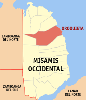
Oroquieta
Appearance
Page Module:Infobox/styles.css has no content.
| Oroquieta | |||
|---|---|---|---|
| Siyudad | |||
| |||
 Lokasyon na Oroquieta | |||
 | |||
| 8°28′48″N 123°48′0″E | |||
| Dalin | Filipinas | ||
| Barangay | 47 | ||
| Kaawang | |||
| • Katiponan | 237.88 km2 (91.85 sq mi) | ||
| Elebasyon | 138 m (453 ft) | ||
| Bilang na too (Mayo 1, 2020)[1] | |||
| • Katiponan | 72,301 | ||
| • Densidad | 300/km2 (790/sq mi) | ||
| Economia | |||
| • Clase | kumapat ya klase a siyudad | ||
| • Ingresos | ₱700,683,192.00317,686,968.85332,702,499.65382,243,245.00426,269,487.00467,894,109.00523,551,818.00571,959,809.00637,037,176.00751,826,326.00988,304,665.00 (2020) | ||
| • Activos | ₱2,062,574,101.00891,500,404.93914,034,147.00959,862,513.00104,353,536.101,192,055,978.001,388,298,540.001,845,128,350.001,814,361,255.002,247,125,222.002,798,017,229.00 (2020) | ||
| • Pasivos | ₱379,466,821.00293,166,085.28270,208,959.00246,177,036.00252,528,218.00279,079,419.00262,685,291.00489,928,790.00346,396,933.00395,681,263.00653,227,872.00 (2020) | ||
| • Gastos | ₱500,679,044.00236,281,418.30111,223,829.52307,786,713.00314,296,417.00333,234,850.00390,879,335.00434,516,678.00520,949,504.00571,566,530.00736,416,671.00 (2020) | ||
| Kodigo na postal | 7207 | ||
| Kodigo na lugar | 88 | ||
| Website | www | ||
Say Oroquieta et kumapat ya klase a siyudad ed luyag na Misamis Occidental, Filipinas. Unong ed 1 Mayo 2020 census, say populasyon to et 72,301 totoo tan 17,326 abong. Walay kabaleg tan sukat to ya 237.88 sq. km. Say zip code to et 7207.
Saray barangay
[dumaen | dumaen so pinanlapuan]- Apil
- Binuangan
- Bolibol
- Buenavista
- Bunga
- Buntawan
- Burgos
- Canubay
- Clarin Settlement
- Dolipos Bajo
- Dolipos Alto
- Dulapo
- Dullan Norte
- Dullan Sur
- Lamac Lower
- Lamac Upper
- Langcangan Lower
- Langcangan Proper
- Langcangan Upper
- Layawan
- Loboc Lower
- Loboc Upper
- Rizal Lower
- Malindang
- Mialen
- Mobod
- Ciriaco C. Pastrano (Nilabo)
- Paypayan
- Pines
- Poblacion I
- Poblacion II
- San Vicente Alto
- San Vicente Bajo
- Sebucal
- Senote
- Taboc Norte
- Taboc Sur
- Talairon
- Talic
- Toliyok
- Tipan
- Tuyabang Alto
- Tuyabang Bajo
- Tuyabang Proper
- Rizal Upper
- Victoria
- Villaflor
Demograpiko
[dumaen | dumaen so pinanlapuan]| Taon | Pop. | ±% p.a. |
|---|---|---|
| 1903 | 15,156 | — |
| 1918 | 18,014 | +1.16% |
| 1939 | 21,523 | +0.85% |
| 1948 | 22,837 | +0.66% |
| 1960 | 29,477 | +2.15% |
| 1970 | 38,575 | +2.72% |
| 1975 | 42,497 | +1.96% |
| 1980 | 47,328 | +2.18% |
| 1990 | 52,500 | +1.04% |
| 1995 | 56,012 | +1.22% |
| 2000 | 59,843 | +1.43% |
| 2007 | 65,349 | +1.22% |
| 2010 | 68,945 | +1.97% |
| 2015 | 70,757 | +0.50% |
| 2020 | 72,301 | +0.43% |
| Reperensiya: Philippine Statistics Authority[2][3][4] | ||
Saray reperensiya
[dumaen | dumaen so pinanlapuan]- ↑ "2020 Census of Population and Housing (2020 CPH) Population Counts Declared Official by the President". Hulyo 7, 2021. https://psa.gov.ph/content/2020-census-population-and-housing-2020-cph-population-counts-declared-official-president.
- ↑ Census of Population (2015). "Region X (Northern Mindanao)". Total Population by Province, City, Municipality and Barangay. PSA. Retrieved 29 June 2016.
- ↑ Census of Population and Housing (2010). "Region X (Northern Mindanao)". Total Population by Province, City, Municipality and Barangay. NSO. Retrieved 29 June 2016.
- ↑ Censuses of Population (1903–2007). "Region X (Northern Mindanao)". Table 1. Population Enumerated in Various Censuses by Province/Highly Urbanized City: 1903 to 2007. NSO.


