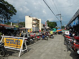
Umingan
Appearance
Page Module:Infobox/styles.css has no content.
| Umingan | |
|---|---|
| Baley na Filipinas | |
 | |
 Lokasyon na Umingan | |
 | |
| 15°55′44″N 120°50′31″E | |
| Dalin | Filipinas |
| Angipaletnegan | Mayo 5, 1843 |
| Barangay | 58 |
| Kaawang | |
| • Katiponan | 258.43 km2 (99.78 sq mi) |
| Elebasyon | 115 m (377 ft) |
| Bilang na too (Mayo 1, 2020)[1] | |
| • Katiponan | 77,074 |
| • Densidad | 300/km2 (770/sq mi) |
| Economia | |
| • Clase | unaan ya klase ya baley |
| • Ingresos | ₱249,767,567.93 (2020) |
| • Activos | ₱457,103,090.21 (2020) |
| • Pasivos | ₱73,011,793.59 (2020) |
| • Gastos | ₱257,322,718.69 (2020) |
| Kodigo na postal | 2443 |
| Kodigo na lugar | 75 |
| Website | www |
Say Umingan et unaan ya klase ya baley ed luyag na Pangasinan, Filipinas. Unong ed 1 Mayo 2020 census, say populasyon to et 77,074 totoo tan 20,380 abong. Walay kabaleg tan sukat to ya 258.43 sq. km. Say zip code to et 2443.
Saray barangay
[dumaen | dumaen so pinanlapuan]- Abot Molina
- Alo-o
- Amaronan
- Annam
- Bantug
- Baracbac
- Barat
- Buenavista
- Cabalitian
- Cabaruan
- Cabatuan
- Cadiz
- Calitlitan
- Capas
- Carosalesan
- Casilan
- Caurdanetaan
- Concepcion
- Decreto
- Diaz
- Diket
- Don Justo Abalos (Caroan)
- Don Montano
- Esperanza
- Evangelista
- Flores
- Fulgosino
- Gonzales
- La Paz
- Labuan
- Lauren
- Lubong
- Luna Weste
- Luna Este
- Mantacdang
- Maseil-seil
- Nampalcan
- Nancalabasaan
- Pangangaan
- Papallasen
- Pemienta
- Poblacion East
- Poblacion West
- Prado
- Resurreccion
- Ricos
- San Andres
- San Juan
- San Leon
- San Pablo
- San Vicente
- Santa Maria
- Santa Rosa
- Sinabaan
- Tanggal Sawang
- Cabangaran
- Carayungan Sur
- Del Rosario
Demograpiko
[dumaen | dumaen so pinanlapuan]| Taon | Pop. | ±% p.a. |
|---|---|---|
| 1903 | 5,761 | — |
| 1918 | 16,356 | +7.20% |
| 1939 | 24,960 | +2.03% |
| 1948 | 29,729 | +1.96% |
| 1960 | 30,664 | +0.26% |
| 1970 | 36,135 | +1.65% |
| 1975 | 40,880 | +2.51% |
| 1980 | 41,364 | +0.24% |
| 1990 | 48,003 | +1.50% |
| 1995 | 51,693 | +1.40% |
| 2000 | 58,603 | +2.73% |
| 2007 | 62,497 | +0.89% |
| 2010 | 67,534 | +2.86% |
| 2015 | 73,252 | +1.56% |
| 2020 | 77,074 | +1.01% |
| Reperensiya: Philippine Statistics Authority[2][3][4] | ||
Saray reperensiya
[dumaen | dumaen so pinanlapuan]- ↑ "2020 Census of Population and Housing (2020 CPH) Population Counts Declared Official by the President". Hulyo 7, 2021. https://psa.gov.ph/content/2020-census-population-and-housing-2020-cph-population-counts-declared-official-president.
- ↑ Census of Population (2015). "Region I (Ilocos Region)". Total Population by Province, City, Municipality and Barangay. PSA. Retrieved 29 June 2016.
- ↑ Census of Population and Housing (2010). "Region I (Ilocos Region)". Total Population by Province, City, Municipality and Barangay. NSO. Retrieved 29 June 2016.
- ↑ Censuses of Population (1903–2007). "Region I (Ilocos Region)". Table 1. Population Enumerated in Various Censuses by Province/Highly Urbanized City: 1903 to 2007. NSO.
