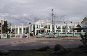
Tabuk
Appearance
(Redirected from Tabuk, Kalinga)
Page Module:Infobox/styles.css has no content.
| Tabuk | |
|---|---|
| Siyudad | |
 | |
 Lokasyon na Tabuk | |
 | |
| 17°24′25″N 121°26′33″E | |
| Dalin | Filipinas |
| Angipaletnegan | Hunyo 16, 1950 |
| Barangay | 43 |
| Kaawang | |
| • Katiponan | 700.25 km2 (270.37 sq mi) |
| Elebasyon | 293 m (961 ft) |
| Bilang na too (Mayo 1, 2020)[1] | |
| • Katiponan | 121,033 |
| • Densidad | 170/km2 (450/sq mi) |
| Economia | |
| • Clase | kumalima ya klase a siyudad |
| • Ingresos | ₱1,186,416,281.24 (2020) |
| • Activos | ₱2,840,749,738.13 (2020) |
| • Pasivos | ₱390,898,150.83 (2020) |
| • Gastos | ₱1,005,536,046.99 (2020) |
| Kodigo na postal | 3800 |
| Kodigo na lugar | 74 |
| Website | www |
Say Tabuk et kumalima ya klase a siyudad ed luyag na Kalinga, Filipinas. Unong ed 1 Mayo 2020 census, say populasyon to et 121,033 totoo tan 25,731 abong. Walay kabaleg tan sukat to ya 700.25 sq. km. Say zip code to et 3800.
Saray barangay
[dumaen | dumaen so pinanlapuan]Say Tabuk walay 42 ya barangay.
- Agbannawag
- Amlao
- Appas
- Bagumbayan
- Balawag
- Balong
- Bantay
- Bulanao
- Bulanao Norte
- Cabaritan
- Cabaruan
- Calaccad
- Calanan
- Dilag
- Dupag
- Gobgob
- Guilayon
- Ipil
- Lanna
- Laya East
- Laya West
- Lucog
- Magnao
- Magsaysay
- Malalao
- Masablang
- Nambaran
- Nambucayan
- Naneng
- Dagupan Centro (Pob.)
- San Juan
- Suyang
- Tuga
- Bado Dangwa
- Bulo
- Casigayan
- Cudal
- Dagupan Weste
- Lacnog
- Malin-awa
- New Tanglag
- San Julian
Demograpiko
[dumaen | dumaen so pinanlapuan]| Taon | Pop. | ±% p.a. |
|---|---|---|
| 1918 | 4,079 | — |
| 1939 | 3,343 | −0.94% |
| 1948 | 7,376 | +9.19% |
| 1960 | 21,261 | +9.22% |
| 1970 | 28,016 | +2.79% |
| 1975 | 33,918 | +3.91% |
| 1980 | 42,768 | +4.74% |
| 1990 | 57,200 | +2.95% |
| 1995 | 63,507 | +1.98% |
| 2000 | 78,633 | +4.69% |
| 2007 | 87,912 | +1.55% |
| 2010 | 103,912 | +6.27% |
| 2015 | 110,642 | +1.20% |
| 2020 | 121,033 | +1.78% |
| Reperensiya: Philippine Statistics Authority[2][3][4] | ||
Saray reperensiya
[dumaen | dumaen so pinanlapuan]- ↑ "2020 Census of Population and Housing (2020 CPH) Population Counts Declared Official by the President". Hulyo 7, 2021. https://psa.gov.ph/content/2020-census-population-and-housing-2020-cph-population-counts-declared-official-president.
- ↑ Census of Population (2015). "Cordillera Administrative Region (CAR)". Total Population by Province, City, Municipality and Barangay. PSA. Retrieved 29 June 2016.
- ↑ Census of Population and Housing (2010). "Cordillera Administrative Region (CAR)". Total Population by Province, City, Municipality and Barangay. NSO. Retrieved 29 June 2016.
- ↑ Censuses of Population (1903–2007). "Cordillera Administrative Region (CAR)". Table 1. Population Enumerated in Various Censuses by Province/Highly Urbanized City: 1903 to 2007. NSO.
