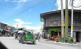
Surallah
Appearance
| Surallah | |
|---|---|
| Baley na Filipinas | |
 | |
 Lokasyon na Surallah | |
 | |
| 6°22′12″N 124°43′48″E | |
| Dalin | Filipinas |
| Barangay | 17 |
| Kaawang | |
| • Katiponan | 540.30 km2 (208.61 sq mi) |
| Elebasyon | 192 m (630 ft) |
| Bilang na too (Mayo 1, 2020)[1] | |
| • Katiponan | 89,340 |
| • Densidad | 170/km2 (430/sq mi) |
| Economia | |
| • Clase | unaan ya klase ya baley |
| • Ingresos | ₱433,864,528.31 (2020) |
| • Activos | ₱981,625,916.98 (2020) |
| • Pasivos | ₱341,689,865.84 (2020) |
| • Gastos | ₱315,902,671.86 (2020) |
| Kodigo na postal | 9512 |
| Kodigo na lugar | 83 |
| Website |
www |
Say Surallah et unaan ya klase ya baley ed luyag na South Cotabato, Filipinas. Unong ed 1 Mayo 2020 census, say populasyon to et 89,340 totoo tan 22,856 abong. Walay kabaleg tan sukat to ya 540.30 sq. km. Say zip code to et 9512.
Saray barangay
[dumaen | dumaen so pinanlapuan]- Buenavista
- Centrala
- Colongulo
- Dajay
- Duengas
- Canahay (Godwino)
- Lambontong
- Lamian
- Lamsugod
- Libertad (Pob.)
- Little Baguio
- Moloy
- Naci (Doce)
- Talahik
- Tubiala
- Upper Sepaka
- Veterans
Demograpiko
[dumaen | dumaen so pinanlapuan]| Taon | Pop. | ±% p.a. |
|---|---|---|
| 1970 | 45,631 | — |
| 1975 | 47,165 | +0.67% |
| 1980 | 52,703 | +2.24% |
| 1990 | 54,136 | +0.27% |
| 1995 | 61,509 | +2.42% |
| 2000 | 66,208 | +1.59% |
| 2007 | 71,513 | +1.07% |
| 2010 | 76,035 | +2.26% |
| 2015 | 84,539 | +2.04% |
| 2020 | 89,340 | +1.09% |
| Reperensiya: Philippine Statistics Authority[2][3][4] | ||
Saray reperensiya
[dumaen | dumaen so pinanlapuan]- ↑ "2020 Census of Population and Housing (2020 CPH) Population Counts Declared Official by the President". Hulyo 7, 2021. https://psa.gov.ph/content/2020-census-population-and-housing-2020-cph-population-counts-declared-official-president.
- ↑ Census of Population (2015). "Region XII (Soccsksargen)". Total Population by Province, City, Municipality and Barangay. PSA. Retrieved 29 June 2016.
- ↑ Census of Population and Housing (2010). "Region XII (Soccsksargen)". Total Population by Province, City, Municipality and Barangay. NSO. Retrieved 29 June 2016.
- ↑ Censuses of Population (1903–2007). "Region XII (Soccsksargen)". Table 1. Population Enumerated in Various Censuses by Province/Highly Urbanized City: 1903 to 2007. NSO.
