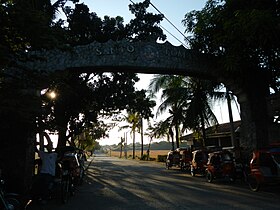
Santo Tomas, La Union
Appearance
| Santo Tomas | |
|---|---|
| Baley na Filipinas | |
 | |
 Lokasyon na Santo Tomas | |
 | |
| 16°16′48″N 120°22′48″E | |
| Dalin | Filipinas |
| Barangay | 24 |
| Kaawang | |
| • Katiponan | 64.00 km2 (24.71 sq mi) |
| Elebasyon | 42 m (138 ft) |
| Bilang na too (Mayo 1, 2020)[1] | |
| • Katiponan | 40,846 |
| • Densidad | 640/km2 (1,700/sq mi) |
| Economia | |
| • Clase | kumapat ya klase ya baley |
| • Ingresos | ₱144,066,732.77 (2020) |
| • Activos | ₱787,677,006.16 (2020) |
| • Pasivos | ₱82,553,843.19 (2020) |
| • Gastos | ₱129,122,589.94 (2020) |
| Kodigo na postal | 2516 |
| Kodigo na lugar | 72 |
| Website |
www |
Say Santo Tomas et kumapat ya klase ya baley ed luyag na La Union, Filipinas. Unong ed 1 Mayo 2020 census, say populasyon to et 40,846 totoo tan 10,392 abong. Walay kabaleg tan sukat to ya 64.00 sq. km. Say zip code to et 2516.
Saray barangay
[dumaen | dumaen so pinanlapuan]- Ambitacay
- Bail
- Balaoc
- Balsaan
- Baybay
- Cabaruan
- Casantaan
- Casilagan
- Cupang
- Damortis
- Fernando
- Linong
- Lomboy
- Malabago
- Namboongan
- Namonitan
- Narvacan
- Patac
- Poblacion
- Pongpong
- Raois
- Tubod
- Tococ
- Ubagan
Demograpiko
[dumaen | dumaen so pinanlapuan]| Taon | Pop. | ±% p.a. |
|---|---|---|
| 1903 | 5,446 | — |
| 1918 | 8,046 | +2.64% |
| 1939 | 10,352 | +1.21% |
| 1948 | 12,897 | +2.47% |
| 1960 | 14,929 | +1.23% |
| 1970 | 19,482 | +2.69% |
| 1975 | 21,341 | +1.84% |
| 1980 | 22,610 | +1.16% |
| 1990 | 27,352 | +1.92% |
| 1995 | 28,192 | +0.57% |
| 2000 | 31,204 | +2.20% |
| 2007 | 33,604 | +1.03% |
| 2010 | 35,999 | +2.54% |
| 2015 | 39,092 | +1.58% |
| 2020 | 40,846 | +0.87% |
| Reperensiya: Philippine Statistics Authority[2][3][4] | ||
Saray reperensiya
[dumaen | dumaen so pinanlapuan]- ↑ "2020 Census of Population and Housing (2020 CPH) Population Counts Declared Official by the President". Hulyo 7, 2021. https://psa.gov.ph/content/2020-census-population-and-housing-2020-cph-population-counts-declared-official-president.
- ↑ Census of Population (2015). "Region I (Ilocos Region)". Total Population by Province, City, Municipality and Barangay. PSA. Retrieved 29 June 2016.
- ↑ Census of Population and Housing (2010). "Region I (Ilocos Region)". Total Population by Province, City, Municipality and Barangay. NSO. Retrieved 29 June 2016.
- ↑ Censuses of Population (1903–2007). "Region I (Ilocos Region)". Table 1. Population Enumerated in Various Censuses by Province/Highly Urbanized City: 1903 to 2007. NSO.
