Pampanga
Appearance
Page Module:Infobox/styles.css has no content.
| Pampanga | |||
|---|---|---|---|
| Luyag na Filipinas | |||
 | |||
| |||
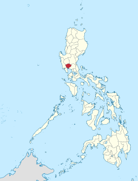
 Lokasyon na Pampanga | |||
 | |||
| 15°4′12″N 120°40′12″E | |||
| Dalin | Filipinas | ||
| Angipaletnegan | 1571 | ||
| Kabesera | San Fernando | ||
| Barangay | 538 | ||
| Gobiyerno | |||
| • Pangulo | Dennis Pineda | ||
| Kaawang | |||
| • Katiponan | 2,002.20 km2 (773.05 sq mi) | ||
| Bilang na too (Mayo 1, 2020)[1] | |||
| • Katiponan | 2,437,709 | ||
| • Densidad | 1,200/km2 (3,200/sq mi) | ||
| Economia | |||
| • Clase | unaan ya klase a luyag | ||
| • Ingresos | ₱3,877,190,307.201,732,843,736.291,899,378,018.822,238,153,137.632,480,469,624.422,690,926,023.882,991,627,797.323,259,191,241.633,409,983,099.994,202,004,940.825,469,152,994.36 (2020) | ||
| • Activos | ₱12,674,123,243.524,040,900,285.924,151,340,671.174,943,669,632.455,593,536,592.236,233,746,975.189,530,313,508.1510,296,466,262.2510,942,878,910.0714,509,458,585.2519,126,721,401.71 (2020) | ||
| • Pasivos | ₱2,400,378,532.111,113,211,182.17874,582,006.271,059,767,298.721,356,726,241.051,537,503,053.041,980,022,915.392,374,042,049.902,204,029,728.342,863,056,781.043,129,327,626.38 (2020) | ||
| • Gastos | ₱2,127,059,152.601,182,813,485.031,594,021,475.011,683,731,776.102,135,133,033.302,184,491,476.112,438,631,647.882,843,468,316.592,298,131,978.182,699,144,512.833,646,113,459.73 (2020) | ||
| Kodigo na postal | 2000–2024 | ||
| Kodigo na lugar | 45 | ||
| Website | www | ||
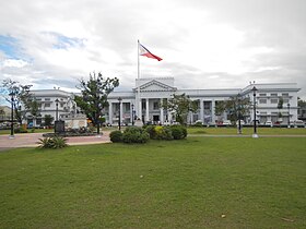
Say Pampanga et unaan ya klase a luyag ed rehiyon na Pegley na Luzon, Filipinas. Unong ed 1 Mayo 2020 census, say populasyon to et 2,437,709 totoo tan 573,920 abong. Walay kabaleg tan sukat to ya 2,002.20 sq. km. Say kodigo telefono +63 (0)45. Say kapital to et San Fernando.
Saray siyudad san baley
[dumaen | dumaen so pinanlapuan]Say Pampanga walay 2 ya siyudad san 20 ya baley.
Saray siyudad
[dumaen | dumaen so pinanlapuan]Saray baley
[dumaen | dumaen so pinanlapuan]Demograpiko
[dumaen | dumaen so pinanlapuan]| Taon | Pop. | ±% p.a. |
|---|---|---|
| 1903 | 223,754 | — |
| 1918 | 257,620 | +0.94% |
| 1939 | 375,281 | +1.81% |
| 1948 | 416,583 | +1.17% |
| 1960 | 617,259 | +3.33% |
| 1970 | 772,731 | +2.27% |
| 1975 | 891,000 | +2.90% |
| 1980 | 992,756 | +2.19% |
| 1990 | 1,295,929 | +2.70% |
| 1995 | 1,401,756 | +1.48% |
| 2000 | 1,618,759 | +3.13% |
| 2007 | 1,911,951 | +2.32% |
| 2010 | 2,014,019 | +1.91% |
| 2015 | 2,198,110 | +1.68% |
| 2020 | 2,437,709 | +2.06% |
| Reperensiya: Philippine Statistics Authority[2][3][4] | ||
Saray reperensiya
[dumaen | dumaen so pinanlapuan]- ↑ "2020 Census of Population and Housing (2020 CPH) Population Counts Declared Official by the President". Hulyo 7, 2021. https://psa.gov.ph/content/2020-census-population-and-housing-2020-cph-population-counts-declared-official-president.
- ↑ Census of Population (2015). "Region III (Central Luzon)". Total Population by Province, City, Municipality and Barangay. PSA. Retrieved 29 June 2016.
- ↑ Census of Population and Housing (2010). "Region III (Central Luzon)". Total Population by Province, City, Municipality and Barangay. NSO. Retrieved 29 June 2016.
- ↑ Censuses of Population (1903–2007). "Region III (Central Luzon)". Table 1. Population Enumerated in Various Censuses by Province/Highly Urbanized City: 1903 to 2007. NSO.
Saray gawing ed labas
[dumaen | dumaen so pinanlapuan]- PhilAtlas.com
- Philippine Standard Geographic Code
- Local Governance Performance Management System
- www
.pampanga .gov .ph - Provincial Government of Pampanga
- Diosdado Macapagal International Airport (DMIA)
- Pampanga and New Kapampangan Writing
| Saray Region san Luyag na Luzon | |
| Sagor na Baybay na Luzon: | Ilocos ed Baybay (Ilocos Norte) | Ilocos ed Abalaten (Ilocos Sur) | La Union | Pangasinan |
| Valley na Cagayan: | Batanes | Cagayan | Isabela | Balon Vizcaya (Nueva Vizcaya) | Quirino |
| Cordillera Administrative Region: | Abra | Apayao | Benguet | Ifugao | Kalinga | Luyag na Palandey |
| Pegley na Luzon: | Aurora | Bataan | Bulacan | Balon Ecija (Nueva Ecija) | Pampanga | Tarlac | Zambales |
| CALABARZON: | Batangas | Cavite | Laguna | Quezon | Rizal |
| MIMAROPA: | Mindoro ed Bokig (Oriental Mindoro) | Mindoro ed Sagor (Occidental Mindoro) | Romblon | Marinduque |
| Rehiyon na Bikol: | Albay | Camarines ed Abalaten (Camarines Sur) | Camarines ed Baybay (Camarines Norte) | Catanduanes | Masbate | Sorsogon |
| Metro Manila: | Agnaluyag |

