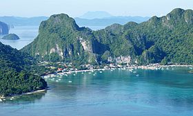
El Nido
Appearance
(Redirected from El Nido, Palawan)
Page Module:Infobox/styles.css has no content.
| El Nido | |
|---|---|
| Baley na Filipinas | |
 | |
 Lokasyon na El Nido | |
 | |
| 11°11′44″N 119°24′27″E | |
| Dalin | Filipinas |
| Barangay | 18 |
| Kaawang | |
| • Katiponan | 923.26 km2 (356.47 sq mi) |
| Elebasyon | 35 m (115 ft) |
| Bilang na too (Mayo 1, 2020)[1] | |
| • Katiponan | 50,494 |
| • Densidad | 55/km2 (140/sq mi) |
| Economia | |
| • Clase | unaan ya klase ya baley |
| • Ingresos | ₱444,279,101.23145,363,127.68164,619,221.22200,114,900.25246,049,031.09196,808,586.54346,678,619.70420,923,922.01486,280,791.38386,797,245.64582,112,475.24 (2020) |
| • Activos | ₱1,412,973,784.81138,503,431.67169,602,861.49240,712,870.02359,207,156.02480,475,579.06701,315,134.63908,530,099.421,202,914,331.971,537,555,928.571,736,640,029.96 (2020) |
| • Pasivos | ₱416,951,883.4251,677,222.1060,863,729.1178,432,475.93101,406,551.93116,143,064.06200,777,123.86209,304,648.85340,854,387.634,778,112,753.94529,158,315.67 (2020) |
| • Gastos | ₱322,280,556.96127,559,842.82141,245,348.01145,737,144.66170,915,180.31191,128,428.74210,334,777.86250,302,902.97294,975,876.34327,949,733.06378,781,291.60 (2020) |
| Kodigo na postal | 5313 |
| Kodigo na lugar | 48 |
| Website | www |
Say El Nido et unaan ya klase ya baley ed luyag na Palawan, Filipinas. Unong ed 1 Mayo 2020 census, say populasyon to et 50,494 totoo tan 12,632 abong. Walay kabaleg tan sukat to ya 923.26 sq. km. Say zip code to et 5313.
Saray barangay
[dumaen | dumaen so pinanlapuan]- Bagong Bayan
- Buena Suerte (Zone II)
- Barotuan
- Bebeladan
- Corong-corong (Zone IV)
- Mabini (nagan na idi a Oton)
- Manlag
- Masagana (Zone III)
- New Ibajay
- Pasadeña
- Maligaya (Zone I)
- San Fernando
- Sibaltan
- Teneguiban
- Villa Libertad
- Villa Paz
- Bucana
- Aberawan
Demograpiko
[dumaen | dumaen so pinanlapuan]| Taon | Pop. | ±% p.a. |
|---|---|---|
| 1918 | 1,789 | — |
| 1939 | 2,280 | +1.16% |
| 1948 | 2,306 | +0.13% |
| 1960 | 4,075 | +4.86% |
| 1970 | 7,358 | +6.08% |
| 1975 | 8,749 | +3.53% |
| 1980 | 11,657 | +5.91% |
| 1990 | 18,832 | +4.91% |
| 1995 | 21,948 | +2.91% |
| 2000 | 27,029 | +4.57% |
| 2007 | 30,249 | +1.56% |
| 2010 | 36,191 | +6.74% |
| 2015 | 41,606 | +2.69% |
| 2020 | 50,494 | +3.88% |
| Reperensiya: Philippine Statistics Authority[2][3][4] | ||
Saray reperensiya
[dumaen | dumaen so pinanlapuan]- ↑ "2020 Census of Population and Housing (2020 CPH) Population Counts Declared Official by the President". Hulyo 7, 2021. https://psa.gov.ph/content/2020-census-population-and-housing-2020-cph-population-counts-declared-official-president.
- ↑ Census of Population (2015). "Region IV-B (Mimaropa)". Total Population by Province, City, Municipality and Barangay. PSA. Retrieved 29 June 2016.
- ↑ Census of Population and Housing (2010). "Region IV-B (Mimaropa)". Total Population by Province, City, Municipality and Barangay. NSO. Retrieved 29 June 2016.
- ↑ Censuses of Population (1903–2007). "Region IV-B (Mimaropa)". Table 1. Population Enumerated in Various Censuses by Province/Highly Urbanized City: 1903 to 2007. NSO.
Saray gawing ed labas
[dumaen | dumaen so pinanlapuan]- PhilAtlas.com
- Philippine Standard Geographic Code
- Local Governance Performance Management System
- www
.elnidopalawan .gov .ph
