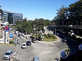
Baguio
(Redirected from Siyudad na Baguio)
| Baguio | ||
|---|---|---|
| Marakel ya siyudad | ||
 | ||
| ||
 Lokasyon na Baguio | ||
 | ||
| 16°24′43″N 120°35′36″E | ||
| Dalin | Filipinas | |
| Angipaletnegan | 1900 | |
| Barangay | 129 | |
| Kaawang | ||
| • Katiponan | 57.51 km2 (22.20 sq mi) | |
| Elebasyon | 853 m (2,799 ft) | |
| Bilang na too (Mayo 1, 2020)[1] | ||
| • Katiponan | 366,358 | |
| • Densidad | 6,400/km2 (16,000/sq mi) | |
| Economia | ||
| • Clase | unaan ya klase a siyudad | |
| • Ingresos | ₱2,162,365,461.20 (2020) | |
| • Activos | ₱11,277,551,115.79 (2020) | |
| • Pasivos | ₱4,811,430,050.36 (2020) | |
| • Gastos | ₱1,420,203,715.99 (2020) | |
| Kodigo na postal | 2600 | |
| Kodigo na lugar | 74 | |
| Website |
www | |
Say Baguio et unaan ya klase a siyudad ed luyag na Cordillera Administrative Region, Filipinas. Unong ed 1 Mayo 2020 census, say populasyon to et 366,358 totoo tan 100,220 abong. Walay kabaleg tan sukat to ya 57.51 sq. km. Say zip code to et 2600.
Saray barangay[dumaen | dumaen so pinanlapuan]
- Apugan-Loakan
- Asin Road
- Atok Trail
- Bakakeng Central
- Bakakeng North
- Happy Hollow
- Balsigan
- Bayan Park West (Bayan Park)
- Bayan Park East
- Brookspoint
- Brookside
- Cabinet Hill-Teacher’s Camp
- Camp Allen
- Camp 7
- Camp 8
- Campo Filipino
- City Camp Central
- City Camp Proper
- Country Club Village
- Cresencia Village
- Dagsian, Upper
- DPS Area
- Dizon Subdivision
- Quirino Hill, East
- Engineers' Hill
- Fairview Village
- Fort del Pilar
- General Luna, Upper
- General Luna, Lower
- Gibraltar
- Greenwater Village
- Guisad Central
- Guisad Sorong
- Hillside
- Holy Ghost Extension
- Holy Ghost Proper
- Imelda Village
- Irisan
- Kayang Extension
- Kias
- Kagitingan
- Loakan Proper
- Lopez Jaena
- Lourdes Subdivision Extension
- Dagsian, Lower
- Lourdes Subdivision, Lower
- Quirino Hill, Lower
- General Emilio F. Aguinaldo
- Lualhati
- Lucnab
- Magsaysay, Lower
- Magsaysay Private Road
- Aurora Hill Proper
- Bal-Marcoville (Marcoville)
- Quirino Hill, Middle
- Military Cut-off
- Mines View Park
- Modern Site, East
- Modern Site, West
- New Lucban
- Aurora Hill, North Central
- Sanitary Camp, North
- Outlook Drive
- Pacdal
- Pinget
- Pinsao Pilot Project
- Pinsao Proper
- Puliwes
- Pucsusan
- MRR-Queen Of Peace
- Rock Quarry, Lower
- Salud Mitra
- San Antonio Village
- San Luis Village
- San Roque Village
- San Vicente
- Santa Escolastica
- Santo Rosario
- Santo Tomas School Area
- Santo Tomas Proper
- Scout Barrio
- Session Road Area
- Slaughter House Area
- Sanitary Camp South
- Saint Joseph Village
- Teodora Alonzo
- Trancoville
- Rock Quarry, Upper
- Victoria Village
- Quirino Hill, West
- Andres Bonifacio (Lower Bokaw
- Legarda-Burnham-Kisad
- Imelda R. Marcos (La Salle)
- Lourdes Subdivision, Proper
- Quirino-Magsaysay, Upper (Upp
- A. Bonifacio-Caguioa-Rimando
- Ambiong
- Aurora Hill, South Central
- Abanao-Zandueta-Kayong-Chugum
- Bagong Lipunan (Market Area)
- BGH Compound
- Bayan Park Village
- Camdas Subdivision
- Palma-Urbano (Cari?o-Palma)
- Dominican Hill Mirador
- Alfonso Tabora
- Dontogan
- Ferdinand (Happy Homes-Campo)
- Happy Homes (Happy Homes-Lucban)
- Harrison-Claudio Carantes
- Honeymoon (Honeymoon-Holy Ghost)
- Kabayanihan
- Kayang-Hilltop
- Gabriela Silang
- Liwanag-Loakan
- Malcolm Square-Perfecto
- Manuel A. Roxas
- Padre Burgos
- Quezon Hill, Upper
- Rock Quarry, Middle
- Phil-Am
- Quezon Hill Proper
- Middle Quezon Hill Subdivision
- Rizal Monument Area
- SLU-SVP Housing Village
- South Drive
- Magsaysay, Upper
- Market Subdivision, Upper
- Padre Zamora
Demograpiko[dumaen | dumaen so pinanlapuan]
| Taon | Pop. | ±% p.a. |
|---|---|---|
| 1918 | 5,464 | — |
| 1939 | 24,117 | +7.33% |
| 1948 | 29,262 | +2.17% |
| 1960 | 50,436 | +4.64% |
| 1970 | 84,538 | +5.29% |
| 1975 | 97,449 | +2.89% |
| 1980 | 119,009 | +4.08% |
| 1990 | 183,142 | +4.41% |
| 1995 | 226,883 | +4.09% |
| 2000 | 252,386 | +2.31% |
| 2007 | 301,926 | +2.50% |
| 2010 | 318,676 | +1.98% |
| 2015 | 345,366 | +1.54% |
| 2020 | 366,358 | +1.17% |
| Reperensiya: Philippine Statistics Authority[2][3][4] | ||
Saray reperensiya[dumaen | dumaen so pinanlapuan]
- ↑ "2020 Census of Population and Housing (2020 CPH) Population Counts Declared Official by the President". Hulyo 7, 2021. https://psa.gov.ph/content/2020-census-population-and-housing-2020-cph-population-counts-declared-official-president.
- ↑ Census of Population (2015). "Cordillera Administrative Region (CAR)". Total Population by Province, City, Municipality and Barangay. PSA. Retrieved 29 June 2016.
- ↑ Census of Population and Housing (2010). "Cordillera Administrative Region (CAR)". Total Population by Province, City, Municipality and Barangay. NSO. Retrieved 29 June 2016.
- ↑ Censuses of Population (1903–2007). "Cordillera Administrative Region (CAR)". Table 1. Population Enumerated in Various Censuses by Province/Highly Urbanized City: 1903 to 2007. NSO.

