
File:EU-Greece.svg

Size of this PNG preview of this SVG file: 713 × 600 pixels. Other resolutions: 285 × 240 pixels | 571 × 480 pixels | 913 × 768 pixels | 1,218 × 1,024 pixels | 2,435 × 2,048 pixels | 2,045 × 1,720 pixels.
Original file (SVG file, nominally 2,045 × 1,720 pixels, file size: 7.33 MB)
Sumaryo
| Deskripsion |
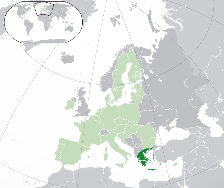
English: (Dark-Green) Greece. (Light-Green) The rest of the European Union (EU). (Dark-gray) The rest of Europe. (Light-gray) The surrounding region.
See also: |
| SVG genesis | |
| Agew | |
| Pinanlapuan | |
| Autor | NuclearVacuum |
| Other versions |
|


Licensing
I, the copyright holder of this work, hereby publish it under the following licenses:
This file is licensed under the Creative Commons Attribution-Share Alike 3.0 Unported license.
- You are free:
- to share – to copy, distribute and transmit the work
- to remix – to adapt the work
- Under the following conditions:
- attribution – You must give appropriate credit, provide a link to the license, and indicate if changes were made. You may do so in any reasonable manner, but not in any way that suggests the licensor endorses you or your use.
- share alike – If you remix, transform, or build upon the material, you must distribute your contributions under the same or compatible license as the original.

|
Permission is granted to copy, distribute and/or modify this document under the terms of the GNU Free Documentation License, Version 1.2 or any later version published by the Free Software Foundation; with no Invariant Sections, no Front-Cover Texts, and no Back-Cover Texts. A copy of the license is included in the section entitled GNU Free Documentation License. |
You may select the license of your choice.
File history
Click on a date/time to view the file as it appeared at that time.
| Agew/Oras | Thumbnail | Dimensions | Manguusar | Komento | |
|---|---|---|---|---|---|
| kaplesan | 04:58, 1 Pebrero 2020 | | 2,045 × 1,720 (7.33 MB) | Rob984 | UK and Gibraltar have left the EU. New base which includes all of Portugal's islands within frame, as well as Arctic Russian islands part of Europe. Also fixed Flevoland in the Netherlands. |
| 20:30, 25 Oktubre 2016 |  | 2,045 × 1,720 (7.32 MB) | Giorgi Balakhadze | Rv of sockpuppet and per COM:OVERWRITE | |
| 04:05, 23 Hulyo 2015 |  | 2,045 × 1,720 (7.39 MB) | Polyethylen | Reverted to version as of 07:47, 22 July 2015 | |
| 23:46, 22 Hulyo 2015 |  | 723 × 601 (1.05 MB) | Viet-hoian1 | Minor, though relevant corrections on the map of Greece | |
| 18:02, 22 Hulyo 2015 |  | 641 × 585 (926 KB) | Viet-hoian1 | Reverted to version as of 03:20, 22 July 2015 I'm not deleting, I'm just reverting. That map might be appropriate on an EU-related article, I don't think it's appropriate concerning to Greece itself. | |
| 07:47, 22 Hulyo 2015 |  | 2,045 × 1,720 (7.39 MB) | Kalinowski | Reverted to version as of 17:19, 21 July 2015 It is another map. Don't delete previous one. | |
| 03:20, 22 Hulyo 2015 |  | 641 × 585 (926 KB) | Viet-hoian1 | Reverted to version as of 08:11, 21 July 2015 | |
| 17:19, 21 Hulyo 2015 |  | 2,045 × 1,720 (7.39 MB) | Kalinowski | Reverted to version as of 04:12, 24 February 2015 | |
| 08:11, 21 Hulyo 2015 |  | 641 × 585 (926 KB) | Viet-hoian1 | Ελλάδα - Grecia - Greece | |
| 04:12, 24 Pebrero 2015 |  | 2,045 × 1,720 (7.39 MB) | Leftcry | Reverted to version as of 19:38, 16 November 2014 Top mapcompletely messed up, main visual messed up |
Saray Gawing
The following page uses this file:
Global file usage
The following other wikis use this file:
- Usage on af.wikipedia.org
- Usage on ami.wikipedia.org
- Usage on an.wikipedia.org
- Usage on arc.wikipedia.org
- Usage on ar.wikipedia.org
- اليونان
- بوابة:البلقان/دولة مختارة/أرشيف
- بوابة:البلقان/دولة مختارة/10
- مستخدم:ElWaliElAlaoui/ملعب 8
- معاملة المثليين في اليونان
- مستخدم:جار الله/قائمة صور مقالات العلاقات الثنائية
- العلاقات الأمريكية اليونانية
- العلاقات الأنغولية اليونانية
- العلاقات اليونانية الكورية الجنوبية
- العلاقات اليونانية الإريترية
- العلاقات اليونانية السويسرية
- العلاقات الألمانية اليونانية
- العلاقات اليونانية الليختنشتانية
- العلاقات اليونانية البوليفية
- العلاقات اليونانية الموزمبيقية
- العلاقات الألبانية اليونانية
- العلاقات اليونانية البلجيكية
- العلاقات اليونانية الإثيوبية
- العلاقات اليونانية البيلاروسية
- العلاقات اليونانية الطاجيكية
- العلاقات اليونانية الروسية
- العلاقات اليونانية الرومانية
- العلاقات الأرجنتينية اليونانية
- العلاقات اليونانية الغامبية
- العلاقات اليونانية القبرصية
- العلاقات اليونانية السيراليونية
- العلاقات اليونانية النيبالية
- العلاقات اليونانية الليبيرية
- العلاقات التشيكية اليونانية
- العلاقات اليونانية الميانمارية
- العلاقات اليونانية الكندية
- العلاقات اليونانية البالاوية
- العلاقات اليونانية المالية
- العلاقات اليونانية النيجيرية
- العلاقات اليمنية اليونانية
- العلاقات اليونانية الفانواتية
- العلاقات الغابونية اليونانية
- العلاقات اليونانية البنمية
- العلاقات اليونانية الكوبية
- العلاقات اليونانية الجورجية
- العلاقات اليونانية التونسية
- العلاقات اليونانية الكورية الشمالية
- العلاقات الهندية اليونانية
- العلاقات اليابانية اليونانية
- العلاقات اليونانية الإيطالية
View more global usage of this file.